The Thermal Comes Off the Lake. The Mountain Wall Does the Rest.


The thermal that lifts you off Sarangkot is generated by Phewa Lake. The Annapurna wall does the rest. A tandem paragliding flight in Pokhara costs approximately NPR 8,500 (around $65 USD), lasts 30 to 45 minutes, and launches from Sarangkot ridge at 1,600m before landing at Lakeside by Phewa Lake, where you also book it. That is the practical answer. The reason Pokhara works as a paragliding site requires a little more.
Why Pokhara is one of the better sites for paragliding
Most paragliding sites earn their reputation through consistent wind or dramatic scenery. Pokhara earns it through a specific convergence of geography.
Phewa Lake sits at 742m in the Pokhara Valley. When the sun heats the lake surface, warm air rises in a column above the water. That column is the thermal you fly in. On its own, a lake thermal is ordinary.
What makes Pokhara different is what happens at the northern edge of the airspace: the Annapurna Range. The mountain wall acts as a deflection barrier, pushing those rising columns upward and holding them stable for longer than open terrain allows. Sarangkot, the launch site at 1,600m on the ridge above the city, sits directly above this system. You step off the ridge already inside the mechanism.
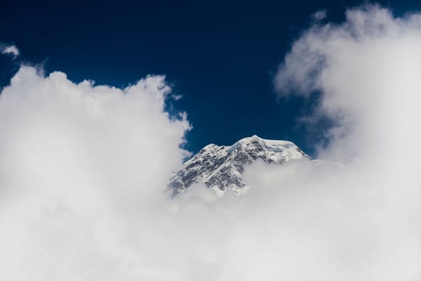
On a clear day, the mountains visible from the air include Annapurna I at 8,091m, Dhaulagiri at 8,167m, and Manaslu at 8,163m. From the ground in Pokhara you see the same peaks. From inside the thermal above Phewa Lake, the relationship between the city, the lake, and the range rearranges itself. The lake below you is not a scenic backdrop. It is the engine.
What a tandem flight looks like
You get to Sarangkot early. The operators prefer morning starts, before midday heat destabilises the thermals. The launch is a short run off a grassy ridge; your pilot handles the canopy inflation and timing. Most people stop running almost immediately.
A traveller writing on wandersmiles.com described the moment: 'We ran together and, all of a sudden, my feet left the ground and the wind took us into the air.' What surprises most people is the absence of drama. A writer on savemountaintreks.com.np put it plainly: no drop, no lurch, you are simply flying before you have registered that you have left the ridge. The canopy fills in three to five steps, and then the ridge is below you.
The flight arc carries you south and east over the city before the thermal column above Phewa Lake takes hold. When that column catches you, it is not a lurch or a drop, it is a slow, sustained lift that pushes the seat of the harness upward rather than pulling your stomach down. Writers covering the Sarangkot experience on savemountaintreks.com.np describe it consistently: the thermal catch feels like the air has made a decision on your behalf. At altitude, the air temperature drops 8 to 12 degrees compared to the ridge. Pokhara reads as a map: the lake to the south, the old bazaar to the north, Lakeside strung along the eastern shore. Machhapuchhre, the fish-tail peak that dominates the skyline from every ground-level viewpoint in the city, sits due north and appears at something closer to eye level than overhead. The Annapurna Range fills the rest of that horizon at what feels like proximity rather than distance.
Pilots brief passengers at the launch site before the run, typically one instruction: run when told and keep running until you are no longer on the ground. One first-timer on TripAdvisor described the briefing as shorter than she expected and the takeoff as faster than she thought possible, with her feet leaving the grass before she had finished processing the instruction. A solo traveller writing on solitarywanderer.com told us they shared the thermal column with hawks, one came close enough that they thought it would hit the canopy. On the descent, some pilots offer a series of spiral turns before the final approach. A traveller on wandersmiles.com described the sensation as feeling yourself drop including your stomach. Unexpected, they noted, and good fun. Pilots at Sunrise Paragliding, where one reviewer noted the chief pilot has been flying this valley for nearly 30 years, typically read thermals from the launch site for several minutes before deciding when to send a passenger, watching other gliders in the column above the lake to judge the air.
The landing zone is a narrow strip of grass beside the lake in Lakeside. Pilots bring you in low over the water, and the approach runs close enough to the surface that you can see the reflection of the canopy in it. Landing requires two or three running steps on contact, though on most flights the pilot touches down first and absorbs the arrival before passenger feet hit ground. A traveller writing about the experience on thisrareearth.com noted that the landing felt more solid than anticipated, and that the return of warm air at lake level was the first moment they registered how cold the altitude had been. The flight lasts 30 to 45 minutes depending on thermals and how your pilot reads the air. Longer is possible. Nothing is guaranteed. The mountain weather is not a product.
What it costs and what that covers
The standard tandem rate is NPR 8,500 per person, roughly $65 USD at current exchange. That covers the flight, harness, helmet, and transport from Lakeside up to Sarangkot. Video and photo packages are sold separately, from NPR 1,500 to NPR 3,000 depending on the operator.
The gap between licensed and unlicensed operators is real. All commercial tandem operations in Pokhara are governed by the Nepal Paragliding Association, which licenses pilots and sets equipment standards. Licensed pilots carry identifiable documentation. The operators clustered along Lakeside near the landing zone are generally within this system. The issue is with informal touts who approach visitors on the street with lower rates and no paperwork. The price difference is not large enough to justify the uncertainty.
The majority of commercial tandem pilots in Pokhara are Nepali. They built this industry.
How to book
Walk into Lakeside and book direct. Licensed operators are clustered along the main strip near the Phewa Lake landing zone. Booking direct cuts the platform commission that online agencies add, and puts you in front of the actual pilot operation. You can see the equipment. You can ask for the pilot's Nepal Paragliding Association license.
The stakes are not abstract. A 2019 Kathmandu Post investigation documented a 2017 accident where the operator 'didn't explain anything about safety measures' before a flight that resulted in serious injuries 40 seconds after takeoff. The Nepal Paragliding Association operator list is publicly accessible. Check your pilot's CIVL certification before suiting up. A street-tout rate below NPR 7,000 almost always signals a problem.
To plan ahead, several operators offer direct booking online. Pre-booking matters mainly in October and November, when morning slots fill. Off-peak, walk-in is straightforward. Things to Do in Pokhara guides that list operators by name are a useful cross-reference.
When to go
Flights run year-round. The best conditions fall between October and May, when post-monsoon and pre-monsoon skies stay clear long enough to give you the Annapurna Range at full visibility. October and November are the most consistent months. February and March offer the same clarity with fewer visitors.
July and August are the deep monsoon. Flights still run on clear days and the thermals are present, but the Annapurna Range disappears behind cloud for days at a time. You might fly and see nothing north of the city. Operators will tell you this honestly. The flight is not less safe in monsoon; the view is less certain. For the full geography lesson, is October to May.
If you fly solo
Tandem is what most visitors do. But Pokhara has a full solo flying community, and the Nepal Paragliding Association governs that too. ACRO flights and cross-country routes tracking the valley and ridge systems north of the city are available to licensed pilots. The cross-country lines from Sarangkot follow the Seti River gorge east and the ridge above Begnas Lake southeast. These routes require reading mountain weather, not riding a maintained thermal column. If you hold a paragliding license from another country, confirm its recognition with the Nepal Paragliding Association before flying solo. The reciprocal arrangements are not automatic.
From the air above Phewa Lake, Pokhara makes a different kind of sense. The city sits where it sits because of the lake, and the lake sits where it sits because of the mountains. The flight does not show you something new. It shows you the arrangement you were already standing inside.