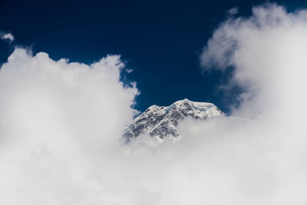
Machhapuchhre: The Peak Nepal Keeps for Its Gods


In 1957, a British expedition led by Colonel James Roberts climbed to within 50 metres of the summit and stopped. Not because the mountain stopped them. Because they had promised King Mahendra they would not set foot on the actual top. They kept that promise, descended, and Nepal closed the peak to all future climbers. Roberts's team came closer to the summit than anyone ever has, and they remain the closest anyone ever will. The Gurung reading of that moment is less forgiving of the climbers than Western mountaineering history tends to be.
The mountain they stopped on is Machhapuchhre. At 6,993 metres above Pokhara, it is the only peak in Nepal with a permanent climbing ban. It is sacred to the Gurung people as the home of Shiva. No permit exists. No permit will be issued.
What Does Machhapuchhre Mean?
The name is Nepali: "fish tail." To understand it, you have to go north. From the Annapurna range, looking back at the peak, you see two summits side by side, a fish tail split at the tip. It is precise, unmistakable.
From Pokhara, you see none of that. The city looks up at a single blade of rock, the southern peak alone, with nothing to compare it to on either side. It looks more like a horn. The name belongs to a view most visitors never see, which is one reason fishtail mountain Nepal descriptions in travel writing tend to describe a shape the writer has only ever seen in photographs.
Western mountaineers gave it another name: the Matterhorn of Nepal. The comparison is to profile, the vertical drama of a single peak detached from the surrounding massif, a shape that reads as a silhouette against the sky before it reads as a mountain at all. At 6,993m, Machhapuchhre is not in the league of Nepal's 8,000m giants, but it does not need to be. Isolation and shape do more for a mountain's presence than height alone.
The Gurung people, known in their own language as Tamu, call the mountain Katasunkli. In Gurung, the name means "snowy fish mouth," a reading of the summit shape from their southern vantage in the valleys below, not the fishtail profile visible from the north. Two names, two positions in the landscape, two centuries of different relationships to the same rock.
From the Annapurna Skyline Trek, crossing to the opposite bank of the Modi Khola Valley, the twin summits of the fishtail reveal themselves at once. It is the one trail position where the name makes sense from ground level, where both peaks appear side by side above the ridge and the shape that gave the mountain its identity becomes legible for the first time.
Why Is Machhapuchhre Sacred?
For the Gurung people, who have lived in the valleys beneath the Annapurna range for centuries, Machhapuchhre is not a peak. It is a threshold. It is the home of Shiva, and as with any inhabited place, you do not enter uninvited.
This is not mythology kept alive for tourists. The Gurung relationship to the land around the Annapurna Sanctuary is tied to farming seasons, burial practices, and the understanding that certain places carry a weight that human activity would disturb. A summit is the highest point of a mountain to a trekker. To the Gurung, the summit of Machhapuchhre is a floor, the ground of something else entirely.
The 1957 climbing ban did not create this protection. It gave it a legal form.
Below the summit, at the glacial lake known as Tin Shir, meaning three heads, there is a pilgrimage site that has drawn Gurung and Hindu worshippers for generations. During Janai Purnima, the full moon festival of Shravan (falling in August), pilgrims historically made the journey up to Tin Shir to offer prayers at the water's edge, with the peak directly above. The lake and the mountain above it functioned together as a threshold space, a place where the boundary between the human world and the domain of Shiva was considered thin. Climbing the peak, in this context, is not a technical question. It is a boundary violation.
Spiritual life in Gurung villages around the Annapurna range is directed by the Pachyu and the Gyabre, shamanic figures whose ceremonial role includes mediating between the community and the forces held in the landscape. Historically, these leaders conducted rituals to appease the presence believed to inhabit the mountain, seeking safe harvests and safe travel. The mountain is not worshipped as a distant abstraction. It is addressed directly, as a neighbour.
A local reading of the 1957 event, documented in the oral tradition of villages below the peak, frames what Roberts's team did quite differently from how Western mountaineering history records it: that unwanted guests in the house of Shiva should be happy they came back alive. Where the Western account credits Roberts with an honourable choice, the Gurung reading places the credit elsewhere. The restraint was not the climbers' achievement. It was the mountain's tolerance.
The 1957 Expedition: 50 Metres From the Top
Colonel James Roberts was one of the most experienced Himalayan climbers of his generation. He had been on Everest. He understood what it cost to get high on a mountain, the months of preparation, the days of exposure, the precise weather window that makes a summit attempt possible.
His team reached the final approach to Machhapuchhre's summit in 1957 and stopped 50 metres below the top. Wilfrid Noyce and A.D.M. Cox made the high point while Roberts managed the expedition from lower on the mountain. They had given their word to King Mahendra that they would not stand on the summit itself. The permit was issued on that condition. Noyce and Cox kept the agreement, turned around, and descended. Some later accounts attributed the retreat to deteriorating weather and heavy snowfall rather than the promise, but the promise was explicit in the expedition record, and Roberts himself treated it as binding.
The ban on further climbing followed. Nepal closed Machhapuchhre to all expeditions, and no permit has been issued since, as recorded in the Himalayan Database maintained by Elizabeth Hawley.
Roberts did not simply accept the closure. After returning from the mountain, he lobbied the Nepal government to declare the peak permanently off-limits. The official ban was formalised in 1962, five years after the expedition. In those five years, a British mountaineer was making the case to the Nepali state that this summit should remain untouched. He kept the promise, then worked to make it permanent.
Fifty metres is nothing on a mountain. In effort terms, it is a few minutes of climbing, the distance between floors of a building. In meaning, it was the difference between a record and a decision. Roberts chose the decision, then spent five years ensuring no one else could choose otherwise.
Every climber who has looked at Machhapuchhre since has looked at a mountain that stopped one team at 50 metres and has not let anyone else that close. The unfinished quality is part of what the mountain has become.
How Machhapuchhre Shapes Pokhara
Pokhara is 28 kilometres from Machhapuchhre. On a clear morning, which in Pokhara means early, before the valley haze builds, the peak appears directly above the city with no visual preamble. No foothills in the way. No competing ridgeline. Just the rock, white at the top.
From a boat on Phewa Lake, Nepal Traveller described looking up at what it called "the smiling virgin Machhapuchhre," a phrase that catches something photographs rarely do: from the water, the untouched quality of the summit reads as expression, not just height. The Tal Barahi Temple on the lake island frames the peak in the background of almost every photograph taken from the boat landing. At alpenglow, the rock walls turn orange, then deepen toward red, the light leaving the summit last. The sequence runs quickly. The orange phase lasts roughly fifteen to twenty minutes between the moment the summit catches first light and the moment the broader sky has brightened enough to neutralise it.
Phewa Lake doubles it. On calm mornings the reflection sits in the water, a perfect inversion. Most photographs of Pokhara contain both versions of the mountain, and most photographers have no idea what they are looking at. It is one of the most photographed skylines in Nepal, and the thing making the photographs is a mountain that cannot be climbed.
Every part of Pokhara has a sightline to it: the lakeside promenade, the old market at Bagar, the airport approach, the road north toward Begnas. Machhapuchhre organises the city's geography the way a spire organises a town square, by being the thing everything else orients toward.
Getting Close: The View From the Trail
The closest most people will ever stand to Machhapuchhre is Sarangkot, the ridge northwest of Pokhara at around 1,600m. It is the standard sunrise viewpoint over the Annapurnas. From the ridge before dawn, the Annapurnas and Machhapuchhre are grey silhouettes against a darker sky. As the sun rises behind the viewer, the peaks move through deep orange to blazing gold in sequence, with Machhapuchhre, being the closest major summit and the most isolated in profile, often catching full colour before the larger Annapurna massif beside it. Machhapuchhre reads from Sarangkot as the sharpest peak in the frame, closer and steeper than its neighbours, which are taller by absolute measure.
To get closer, you walk. The Annapurna Base Camp Trek passes directly beneath the peak. The treeline ends a few hundred metres below MBC and the terrain shifts to open rock, often covered in snow from late autumn to early spring. Stone cairns, prayer flags, and chortens mark the approach, placed by generations of trekkers and by Gurung and Buddhist travellers who have passed through on the way to the Annapurna Sanctuary. At Machhapuchhre Base Camp (MBC), at 3,700m, you stand at the foot of the mountain looking up at rock walls that go straight above you. The peak you have been watching from Pokhara since the first morning is now overhead, the imposing form of the summit taking up the entire skyward horizon. The summit, still more than 3,000m above, is not visible from this angle. The mountain has swallowed the view of itself.
theeverestholiday.com described the moment of arrival at MBC: the gorge opens, the forest ends, the valley floor widens into a rocky plateau of stone tea houses and prayer flags. Then Machhapuchhre appears "rising directly above you in a wall of ice and rock so steep, so close, and so impossibly vertical that your neck aches from looking up." From MBC, both summits visible from the north are hidden. The peak that read as a double blade from a distance is now a single overhanging wall.
The Annapurna Base Camp approach uses Machhapuchhre as its gate. The trail passes through the Modi Khola gorge, with the peak directly above, before the valley opens into the Annapurna Sanctuary, a glacial bowl ringed by eight peaks above 7,000m. Machhapuchhre does not sit inside the sanctuary. It stands at the entrance, watching everything that goes in and comes out.
Can Machhapuchhre Nepal Ever Be Climbed?
No permit has been issued since 1957. Nepal's government has given no indication this will change. The mountain's sacred status under Gurung belief is unchanged. Nearly seventy years of combined religious prohibition and government policy is not a temporary holding pattern.
One complication sits in the record. In 1982, New Zealand climber Bill Denz allegedly made an illegal solo ascent via the N Ridge-NE Face route. Elizabeth Hawley, who maintained the Himalayan Database for decades, included it as a footnote: "rumour has it that a New Zealander [Bill Denz] summited." Denz was killed on Makalu the following year, leaving the claim permanently unverifiable. It sits in the record as a footnote, not a fact.
Even among Gurung intellectuals, the sacred designation has been debated. Jagman Gurung, vice-chancellor of the Nepal Academy and cultural historian, argued that expeditions should not be permitted because the mountain held special religious and cultural significance for the Gurung people. Harka Gurung, a geographer who documented the region extensively, maintained there was no evidence that local people had ever considered the mountain sacred in any formal sense. Both positions were cited in the Nepali Times. The ban endures regardless; the terms on which it stands are less settled than the silence around it suggests.
There is no campaign to open it. The question of whether Machhapuchhre can ever be climbed is, in practice, a question about whether Nepal will decide the Gurung relationship to this mountain matters less than a mountaineering record. That is not a decision Nepal has been moving toward.
There are taller peaks in Nepal, more technical routes, greater fatality records. Machhapuchhre is not the hardest mountain in the range. It is the one where the hardest part happened 50 metres from the top, and the hard part was stopping.
The mountain you can see but never climb is not an absence. It is a presence that the boundary makes possible.