Humla: Nepal's Most Remote District and What It Takes to Get There
Humla borders Tibet and has no road connection to Nepal's main network. What it takes to reach Simikot and what the district offers to those who make it.

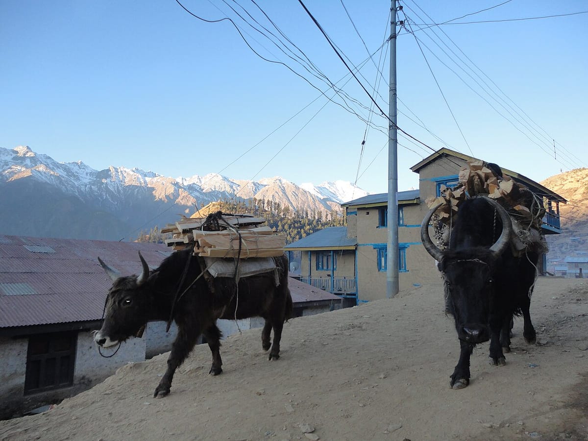
The runway at Simikot is 549 metres long. It sits at 2,900 metres altitude, at the end of a valley, with ridges on three sides. Twin Otter aircraft land here because nothing larger can. The approach requires a specific pilot certification. On days when cloud fills the valley, the flight does not happen. There is no alternate route that takes less than seven days on foot.
This is how you get to Humla - Nepal's second-largest district, its most remote, and one of the least-visited places in a country that receives over a million tourists a year.
Getting There
There are two ways to reach Humla. The first is a 30-minute flight from Nepalgunj or Surkhet to Simikot airport, operated by Mountain Air, Tara Air, or similar small carriers on rotating schedules. Seats are limited. Flights cancel in poor visibility with no guaranteed rebooking. Build a buffer day into any itinerary that depends on this connection.
The second is walking. The traditional route from Jumla to Simikot takes seven to ten days on foot, crossing several passes above 3,000 metres. It is used by local residents and by trekkers who want to arrive the way Humla has always been arrived at - slowly, from below.
There is no road to Simikot. There is no plan for one that has materialised. The logistics that govern Humla - which supplies arrive, which medicines are available, which patients reach a hospital - are all shaped by this. A 30-minute flight or a week's walk. That is the infrastructure.
Simikot
The district headquarters is a market town by the standards of the surrounding landscape: a few streets of stone and corrugated-metal buildings, a cluster of guesthouses built for the pilgrimage trade, government offices, a small hospital. Its population is several thousand. It is the urban centre of a district of 55,496 people spread across 5,655 square kilometres.
Most visitors to Simikot are in transit. They arrive from Nepalgunj with a day pack and a trekking permit, buy supplies in the market, and move north toward the Tibet border. The market reflects this: dried food, emergency gear, kerosene, items that make sense to purchase before a week in the mountains. The town itself is rarely the destination.
What Simikot is, apart from a transit point, is the administrative and logistical centre of a district that would otherwise have no centre at all. The hospital, the government offices, the school with the most resources in the district - these are here because the runway made it possible to put them here.
The airstrip has a reputation that precedes it. Pilots who fly the Simikot route train separately for mountain approaches and are cleared specifically for this terrain. Cancellations due to weather are routine. Passengers wait at Nepalgunj or Surkhet - sometimes for days - until conditions allow. Humla does not accommodate impatience.
The Kailash Route
Approximately 10,000 pilgrims pass through Simikot each year on their way to Mount Kailash and Lake Manasarovar in Tibet. The pilgrimage is one of the most significant in Hinduism and Tibetan Buddhism: Kailash is considered the earthly home of Shiva, and circumambulating it is an act of devotion that Hindus and Buddhists approach differently but take with equal seriousness.
The traditional route through the Friendship Highway - the Tatopani-Zhangmu road - was severely damaged in the 2015 Nepal earthquake. A significant portion of Kailash pilgrimage traffic that had used that route was redirected through Simikot and the Humla corridor to the Hilsa border crossing. This changed the economic character of Simikot. The guesthouses that exist, the permit infrastructure, the flight frequency - these expanded to accommodate the rerouted pilgrimage traffic.
The route from Simikot to Hilsa follows the Humla Karnali River valley northward, crossing the Nara La pass at 4,530 metres. The walk takes four to five days. At Hilsa, the Nepal-Tibet border, pilgrims cross into China and continue by vehicle to Kailash. The Humla corridor is not scenic in the way that Annapurna or Khumbu is scenic. It is remote, dry, and high. That is what pilgrims are there for.
The section from Yalbang to Hilsa covers some of the most remote walking in the Himalaya. There are no guesthouses in the Western sense. Teahouses along the route are basic: a mattress, a blanket, a meal. Trekkers who have walked the Annapurna Circuit call this demanding. Kailash pilgrims who have walked it three or four times call it the point.
Limi Valley
North of the main pilgrimage corridor, accessible by a branch trail that adds several days to any itinerary, the Limi Valley holds eleven villages of Tibetan cultural origin. The communities maintain Tibetan Buddhist traditions, dialect, and architectural style that are distinct from both the Hindu lowlands of Humla and the Tibetan cultural forms that have evolved in the Khumbu and Mustang.
Limi is one of the least-visited destination clusters in Nepal. Access requires a Restricted Area Permit in addition to the Humla National Park entry fee. The permit requirement keeps the valley off the mass-trekking circuit. This is not incidental. It is one of the reasons the valley's cultural character has survived more intact than similar communities on better-connected routes.
The valley's monasteries are active. Its villages are inhabited year-round - a function of the lower altitude compared to the passes above - and the agricultural calendar, the festivals, and the material culture of the communities are not adapted for outside observation. They simply continue.
What Humla Is
Humla is the headwaters of the Karnali River - one of Nepal's major river systems, a Ganges tributary that drains much of western Nepal. The river enters Nepal from Tibet through the Humla corridor and provides the main valley that connects Simikot to the lowlands. The Humla Karnali is not a famous name in the way the Dudh Kosi or the Marsyangdi are famous. It is the river that the district is built around.
In 2014, a survey team confirmed the presence of wild yaks in Humla - the first confirmed sighting in Nepal in decades. The species had been considered regionally extinct. Their rediscovery in the northern reaches of the district is a measure of how little the area has been surveyed, and how much of it remains outside the range of regular human presence.
Namkha Rural Municipality, which covers a large portion of northern Humla, is the largest rural municipality in Nepal by area. It has more square kilometres than most Nepali districts. Almost none of it is accessible by any means other than walking.
The population is approximately 50,000 people across a district larger than some countries. The density is among the lowest in Nepal. Villages are separated not by distance that can be measured in kilometres but by passes that close in October and do not reopen until April. What connects Humla is not infrastructure. It is the Karnali.
Before You Go
Humla requires a Humla Restricted Area Permit for trekking in the northern sections, including the Kailash route and Limi Valley. The standard entry applies to Rara National Park if your route passes through it. Permits are obtained in Kathmandu before departure - not at the district. The flight to Simikot books quickly in the April-May and September-October pilgrimage seasons. October is the clearest month for weather. April and May are warmer but cloud more frequently. Winter access is limited.
Frequently Asked Questions
How do I get to Humla, Nepal?
By a 30-minute flight from Nepalgunj or Surkhet to Simikot airport (Twin Otter aircraft, limited seats, weather-dependent), or by a seven to ten day walk from Jumla. There is no road to Simikot.
Is Humla safe to visit?
Yes, for prepared trekkers with the correct permits. The terrain is remote and high; medical evacuation from the district is by helicopter. Standard altitude and wilderness trekking precautions apply. The Kailash pilgrimage route is established and regularly used.
What is Humla famous for?
As the main access corridor for the Kailash pilgrimage route, which draws approximately 10,000 pilgrims annually. Also for the Limi Valley's Tibetan Buddhist communities, the headwaters of the Karnali River, and as the site of Nepal's wild yak rediscovery in 2014.
What trekking routes go through Humla?
The Simikot-Hilsa-Kailash route (Kailash pilgrimage, four to five days from Simikot to the Tibet border), the Limi Valley circuit (additional four to six days), and the western section of the Great Himalaya Trail, which terminates at Hilsa.
Why is Humla important for the Kailash pilgrimage?
Following earthquake damage to the Friendship Highway route in 2015, Humla became the primary land corridor for Nepal-based Kailash pilgrims. Simikot is the staging town; the Nara La pass (4,530m) connects to the Hilsa border crossing; pilgrims cross into Tibet and continue by vehicle to Kailash.