Annapurna Base Camp Trek: What the Trail Feels Like After the First Teahouse
Annapurna Base Camp is no longer quiet. The teahouses from Chhomrong upwards run at near capacity in October. What that has done to the trail - and what the trek still delivers that the Everest circuit doesn't.

The Annapurna Base Camp trek is sold as the moderate one. The alternative to Everest. The one your knees can survive. This is a marketing sentence, not a geographic one. By day three, anyone who took it at face value has learned the difference. The path does not care what the brochures promise. It climbs and it drops and it climbs again, and the elevation at the end is 4,130 metres, and the stairs between Pokhara and that elevation are the actual medium of the trek.
Nepal is not a mountain country in the way the posters suggest. It is a country with the Himalaya at one end and a plain at the other, and the Annapurna Sanctuary is a single enclosed amphitheatre, not a summary of the nation. For anyone who has arrived in Pokhara with a permit and a pair of boots, this trek will become the country for nine to twelve days. The first three are a warmup. The rest is the answer to a question the warmup does not ask.
The first three days are a warmup that lies
From Nayapul, or from the upper trailheads that shared jeeps have replaced walking with, the trail moves through subtropical terrace. Rice on the lower hills. Hydrangea. Bamboo. Villages with flagstone streets and dogs that watch from the doorways. If you came expecting alpine from hour one, this is not that. It is closer to the middle hills than to the mountains, and the rhythm is gentle enough that the brochure you read begins to feel accurate.
It is not accurate. It is the part before the accounting begins. One redditor who walked it described the arc neatly: ABC does have the neat experience of rising from rice fields through hydrangea and bamboo fields to the sub and true alpine, but it's also navigating endless stairs. The first three days are where the rice fields happen. The stairs come after, and they do not stop.
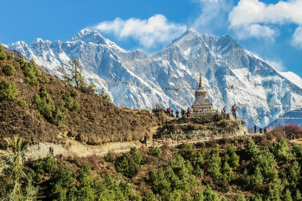
The settlements in this stretch, the Ghandruks and the Landruks, are old Gurung villages that have been on this route since long before it was a route in the brochure sense. The stone staircases in the lower valleys were not built for trekkers. They were built for the movement of people, animals, and goods between hill hamlets, and the trekker is using a village infrastructure that predates the currency the teahouse accepts. This is worth noticing on day one, when the stairs seem picturesque. By day four, they will not.
Chhomrong and the endless stairs of the annapurna base camp trek
Chhomrong is where the trek's arithmetic turns. It is a town on a ridge at 2,170 metres, and the path into it descends hundreds of stone steps to a suspension bridge, then rises hundreds more up the opposite face. That geometry repeats. You lose the altitude you earned. You climb past where you were. You lose it again at Bamboo. The route itself reads, in the way one commenter once summarised it, as lots of vertical gain and stairs. Jhinu → Chomrong → Sinuwa → Bamboo → Dovan. Each arrow is a valley you drop into and climb out of. The trek does not move laterally. It stairsteps.
The numbers are unromantic. One hiker who logged every day wrote plainly: Day 2: 6.1 miles, 4,500 feet, 4.5 hours, 6,462 stairs. Day 6: 6.1 miles, 4,700 feet, 5 hours, 7,030 stairs. These are not outlier days. They are the texture. The knee destruction starts at Chhomrong. If you trained for altitude but not for descent, this is where the training gap presents its invoice. The quadriceps bear the descents. The calves bear the climbs. Both bear the stairs.
What gets you through is not fitness alone. Another trekker who had completed the route put it this way: mental tenacity is far more important because it's about getting yourself up endless flights of stairs, so as long as you have a good baseline health you can do it if you really want to. That is close to the truth. Baseline health is the floor. Above the floor is a willingness to keep moving, meal to meal, stair to stair, in a rhythm that ignores how your legs feel. It is this willingness, more often than the body, that fails first.
The path from Deurali into the enclosed sanctuary
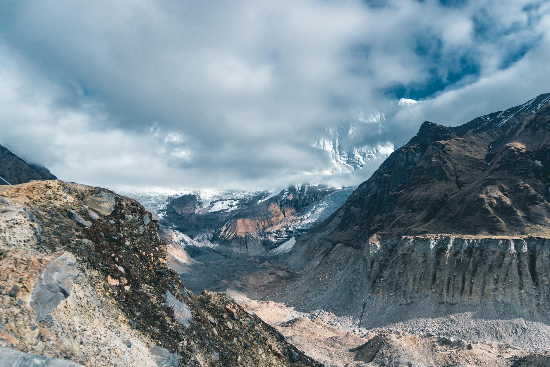
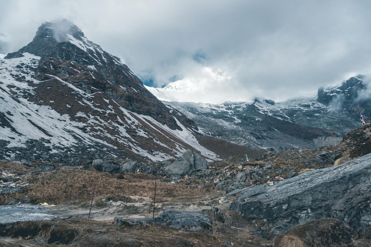
Past Dovan the valley narrows. The rhododendron forest thins. The river below is louder and colder. By Deurali, at 3,230 metres, the temperature has dropped, the trees are shorter, and the trail enters a geologically different world. One redditor who had just completed the stretch described the shift: The scenery changes from Deurali onwards with huge, steep cliffs and snow-capped peaks, but the path is also rugged, broken, and more difficult.
This is the section most people underestimate. The stairs thin; the terrain does not. Landslide scars cross the trail. Snow patches persist into spring and return early in autumn. The sanctuary ahead is an enclosed bowl surrounded by the Annapurna massif, and the weather it keeps is its own. Cloud drops in, cloud lifts, and what you see at 2pm is not what you will see at 5am. Guides do not push past Deurali late in the day, not because the distance is great, but because the weather on the final section is genuinely consequential.
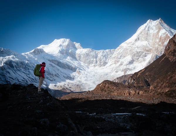
Machhapuchchhre Base Camp, at 3,700 metres, sits halfway between Deurali and the sanctuary. Most itineraries sleep there and walk to ABC in the dark, arriving in time for the dawn. This is not done for the mystique. It is done because it works. The cloud has not yet risen, the peaks are clear, and the light on the south face of Annapurna I, which will be in shadow by midmorning, is visible for a window that closes quickly.
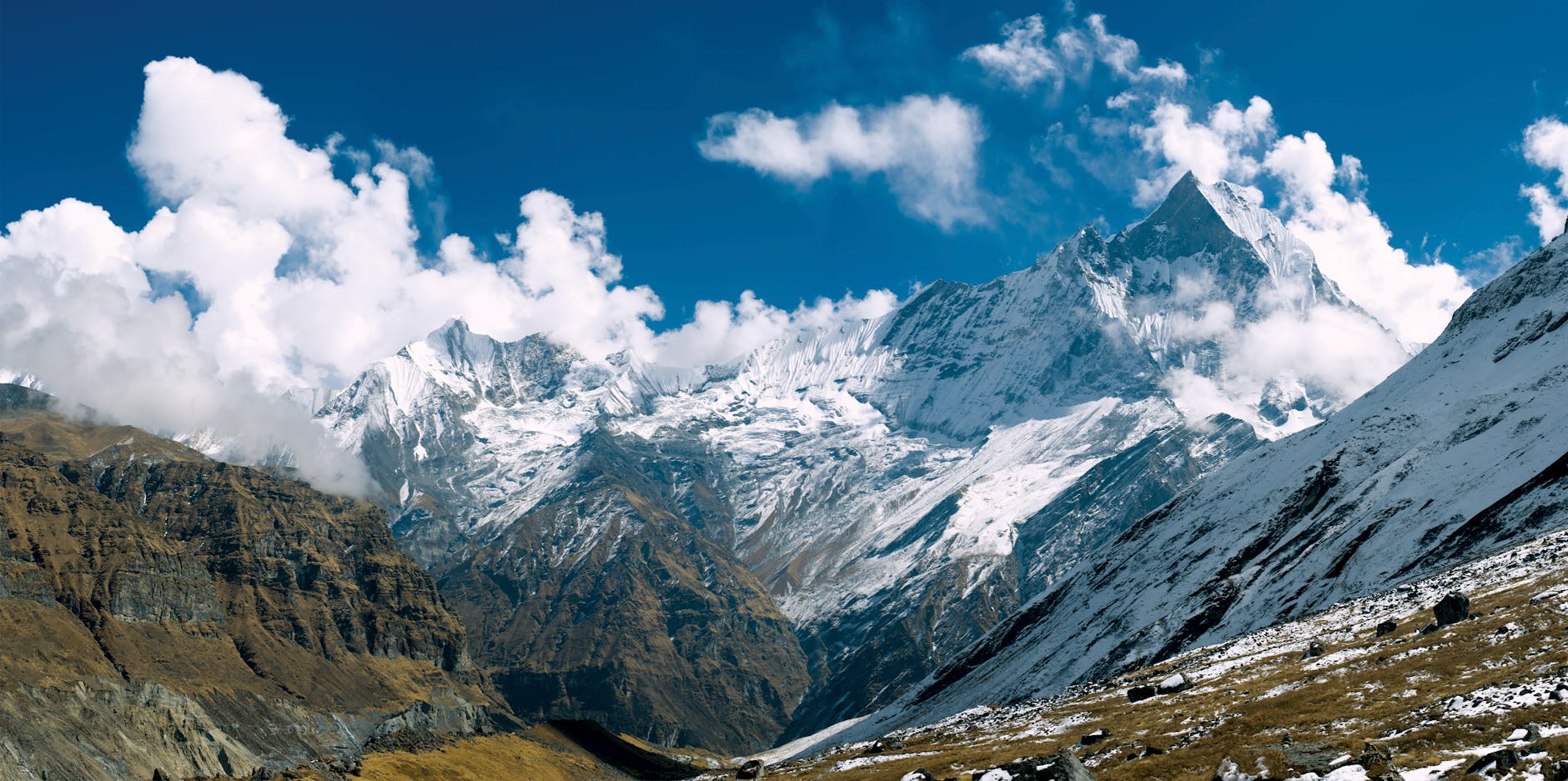
4,130 metres and the weather the sanctuary keeps
The Annapurna Sanctuary is an enclosed amphitheatre. Annapurna I, Annapurna South, Hiunchuli, Machhapuchchhre, Gangapurna. The ring is continuous. Wind from the outer valleys hits it and turns back. What this means for the trekker standing at 4,130 metres is that the weather inside the sanctuary is not the weather of the range around it. It can be clear at Deurali and opaque at base camp within the same afternoon. It can be the opposite.
At dawn, if the sanctuary is clear, the light arrives on the summit of Annapurna I first and travels down the face. This is not a slow event. It takes minutes. By the time the light has reached the ablation zone at the glacier's foot, the ring is already alight, the cloud is already reforming, and the window is closing. People who rushed the trek to spend one morning here, and who caught a clear one, remember that morning. People who spent two mornings doubled their odds. It is a trek built around a weather lottery that cannot be gamed from below.
At this altitude the air has about 60 percent of the oxygen it does in Pokhara. Most people feel it. A minority feel it hard. The sanctuary itself is not a place to linger. Even the guides, after a night and a dawn, want to drop. By lunchtime most people are moving down to Bamboo, and by the second evening of the descent the altitude is no longer the problem. The descent has become the problem.
The teahouse economy and what it costs as you climb
The Annapurna Conservation Area has a teahouse system that is older than most of its trekkers. The lodges are family-run, the food is cooked on kerosene or LPG, and the price curve climbs with the altitude. What is 300 rupees for a plate of dal bhat in Ghandruk is 700 in Deurali and closer to 900 at MBC and ABC. This is not exploitation. Everything above Chhomrong walks in on a porter's back, and the porter has climbed the same stairs you have, carrying more.
What this means practically is that the budget trekker needs to adjust expectations by altitude. Accommodation is often nominal, sometimes free, on the understanding that you will eat at the lodge. The meals are where the economy lives. The menus are almost identical from one lodge to the next, the cook is usually the owner, and the quality varies by family, not by signboard.
A note that repeats in the traveller literature and is worth repeating here: eat smaller, lighter meals more frequently, your digestion slows down at altitude. This is not a comfort tip. At 3,700 metres and above, the stomach works harder and the appetite drops. The people who arrive at ABC and cannot eat are often those who loaded up at Dovan.
The season, the altitude, and how not to rush it
Spring, which in Nepal means March to May, has the rhododendron in bloom on the lower forests and a heavier haze on the peaks. Autumn, October and November, has colder mornings and the clearest air. Winter closes the sanctuary to most trekkers, though the lower loop remains walkable. Monsoon, June to September, is not the season unless leeches and landslides are part of the appeal.
The trek is often done in 7 to 12 days, door to door from Pokhara. The fast end of that range is a mistake. 8 days? You would have to trek real fast, one commenter said, with such aggressive elevation gain, altitude sickness comes to mind. The standard itinerary is 9 to 11 days, and the extra day is usually spent acclimatising at Chhomrong or MBC. It is cheaper in knees and more likely to end at the sanctuary on a clear morning.
For anyone who wants the elevation without the sanctuary commitment, the Poon Hill trek is the alternative. It tops out at 3,210 metres, takes four to five days, and gives a dawn view that includes Dhaulagiri, the Annapurnas, and Machhapuchchhre. It is not the same trek. It is a weekend of what ABC is a longer negotiation with. For a first Nepal trek, or for anyone unsure about altitude, it is the honest choice.
Permits are unromantic too. The Annapurna Conservation Area Project permit and the TIMS card are both required, both issued in Kathmandu or Pokhara, and both checked at staffed posts along the route. Neither is difficult to arrange. Both are cheaper and faster if you bring two passport photos and a photocopy of your passport to the office yourself rather than paying an agent.
What the trail leaves you with
The Annapurna Base Camp trek does not reward romanticism. It rewards arithmetic. It rewards showing up on day four with legs that still work, on day six with food still in the stomach, on day eight at MBC in weather that lets you see the sanctuary the next morning. The people who complete it without crisis are not the fittest. They are the ones who respected the stairs.
Traveller forums are full of people who overstated the difficulty and people who understated it. A useful correction comes from one of them: if you see a caption on any of these hiking blogs or vlogs that says, this was the hardest thing I've ever done in my life, take it with a grain of salt... very surprised at how doable for the average person they all were. This is true and incomplete. The trek is doable. It is also honestly harder than its marketing. Both sentences apply. The first is the brochure. The second is the trail.
What the trek leaves behind is not the photograph of the sanctuary, though almost everyone takes that photograph. It is the memory of the ratio. Of how many stairs were between Jhinu and ABC, and of the morning the body and the head both agreed to keep climbing them. That ratio is the trek. Everything else is the scenery it gave you while you paid.