Sagarmatha National Park: Beyond the Base Camp Queue
Sagarmatha National Park is not just the trail to Everest Base Camp. The buffer zones and quieter valleys above the main route are where the park actually lives.


The park is named for the mountain but the park is not the mountain. Sagarmatha National Park covers 1,148 square kilometres of the Khumbu region, and the summit of Everest sits inside its northern boundary. What sits inside every other part of it receives considerably less attention.
This is about the rest of the park. The mountain can speak for itself.
What is actually in there
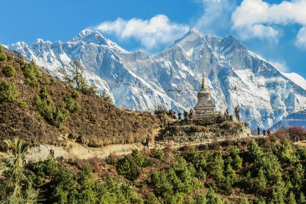
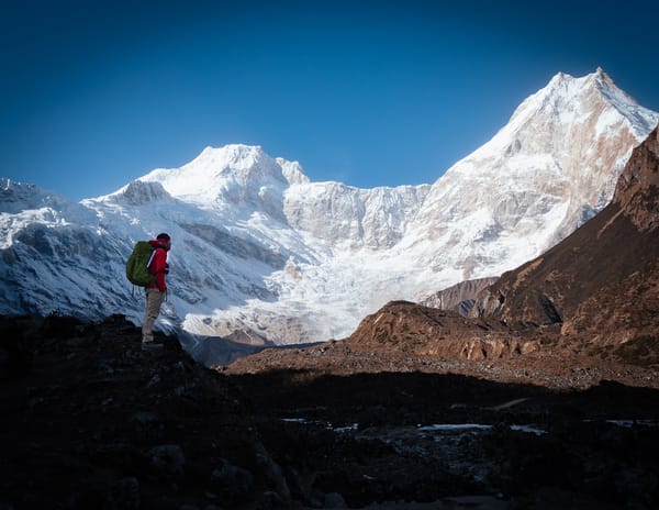
Ama Dablam rises at the park's southeastern edge at 6,812 metres, and its profile, a near-symmetrical spire with long ridges extending like arms, is the view most photographers from the trail are actually shooting when they say they are photographing Everest. Lhotse, at 8,516 metres, shares Everest's south col. Nuptse closes the western wall of the cwm. These are among the most technically challenging peaks on earth and they serve, in the park's tourist economy, as backdrop.
The Gokyo lakes are a chain of glacial lakes at 4,700 to 5,000 metres connected by the Ngozumpa Glacier, Nepal's largest glacier. The Gokyo route runs parallel to the Everest Base Camp route and sees perhaps one-tenth the traffic. In late October, the lakes reflect the peaks without ice on the surface and without the crowds that reach Gokyo in spring.
The Ngozumpa covers approximately 35 square kilometres. It is visibly retreating. The meltwater lakes at its terminus have grown in area by roughly 40 percent over the past twenty years. None of this is speculative. You can see the old margins of the glacier in the moraines it left behind.
The communities inside the boundary

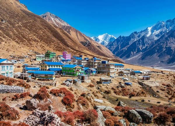
Sagarmatha National Park was gazetted in 1976. The Sherpa communities had been living inside what became the park boundary for several hundred years before that date. When the park was established, the rules it introduced applied to a landscape that people already inhabited and used.
Sherpa households inside the park cannot expand their structures without permits that are difficult to obtain. Pasture land above certain elevations is designated as park territory, which restricts the vertical range of yak herding. The yak herding economy has contracted as a result, partly due to this restriction and partly due to the more profitable shift toward lodge-keeping and trekking support work.
These are not abstract policy questions. They are the conditions under which actual families in Namche Bazaar and Khumjung and Thame plan their lives. I met a man in Khumjung who had applied to add one room to his family's house. The application had been pending for two years. He was philosophical about it. The lodge-keepers are pragmatic people.
The waste
The waste problem at Sagarmatha National Park exists at two scales that are often conflated.
At the summit and on the high routes, tonnes of gear and waste have accumulated over decades of expeditions. A permit-funded cleanup operation has removed significant tonnage over successive seasons. The number most frequently cited is in the range of 10,000 to 15,000 kilograms removed in a single major campaign. What remains is embedded in ice, in crevasses, at altitudes where human working time is strictly limited by oxygen availability. The high-altitude waste is real and it is being addressed, slowly, by the conditions under which it can be addressed.
Below the snowline, the waste problem is different in character. It is the waste of a tourist economy: plastic packaging, single-use bottles, the detritus of several hundred thousand trekker visits per year. The park has bin management systems. It has porter-carried waste removal from the lodges. The systems are imperfect and under pressure from volume.
The clearest thing I can say is this: the trail to Everest Base Camp in peak season looks like a very long thin city. It has all the waste problems of a city.
December
Come in December if you want to understand what the park is actually like.
The trail is quiet. The lodges have heat and food and rooms immediately available. The sky in December is cloudless in a way that it is not in October, when there is still enough moisture in the air to build afternoon cumulus. In December the peaks are visible from the moment you wake until the moment the light fails. Ama Dablam in December morning light is the clearest I have seen it.
The permit costs USD 70 in total, including the Sagarmatha National Park entry, the Trekkers' Information Management System card, and the Khumbu local permit. This applies year-round. The mountain does not charge less in the off-season.
What the off-season gives you is the park without the queue. The trail without the press of people. The lodges with space to sit and the lodge-keepers with time to talk. The Sherpa communities in their own lives rather than in service of other people's pilgrimage.
The mountain will still be there. It is very large. You will not miss it.