Langtang Valley Trek: Walking Through the Earthquake's Aftermath

Langtang Lirung is the god of the place. In Tamang religious tradition, the yulha, the deity of a valley and its protector, lives in the mountain that defines the landscape. For the people of Langtang, that mountain was Langtang Lirung, at 7,234 metres the largest peak visible from the valley floor.
On April 25, 2015, Langtang Lirung sent 40 million tons of rock and ice into the valley below.
This is the wound that no trekking guide has found a way to write about. The protector is also the thing that destroyed what it was protecting. The beyul, the hidden sacred refuge that Tibetan Buddhism understands Langtang to be, a place blessed by Padmasambhava and set aside from ordinary human history, was erased in seconds by the force of its own guardian. The trek to Langtang Valley is, among other things, a walk toward that fact.
What the earthquake did
The official death toll is 243: 175 villagers, 27 local tourism workers (guides and porters), and 41 foreign trekkers. Local estimates put the number closer to 500. The discrepancy exists because many bodies remain beneath the debris. They have not been recovered. The valley absorbed the avalanche and held it.
The debris field in Langtang village sits 20 metres deep in places. Only one building in the original settlement survived. The stone houses, the gompa, the chortens, the fields: still there, sealed under rock. The original site was not excavated. It was not cleared. Trekkers walk over it on the way to the new village.
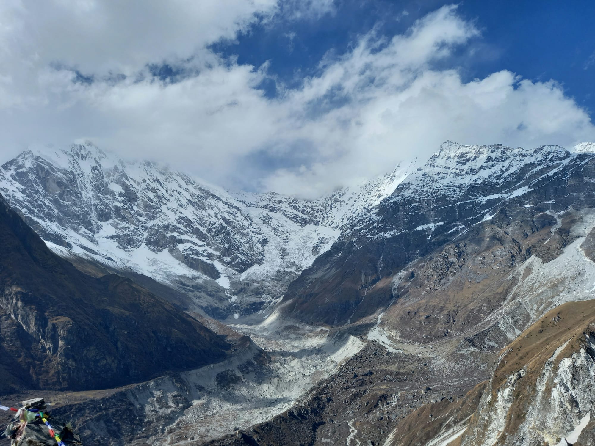
What the approach looks like
The avalanche zone is not visible from a distance. The valley is narrow, forested in its lower reaches, and the path follows the Langtang Khola through terrain that gives no warning of what is ahead. Then you turn a corner. The forest ends. The debris field begins.
Peak Mountaineering, whose guides have worked the route since it reopened, described it plainly: 'If you are trekking to Langtang from the road head you only see the landslide debris as you turn a corner.' Trekkers have described seeing remnants of fabric and other material sticking out of the rock. Signs of the village that was. The scale of it, multiple accounts agree, is impossible to comprehend in the first moment.
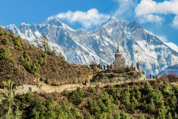
The memorial sits at the edge of the new village: a grey stone stupa with a golden tower, and a mani wall carrying plaques with the names of all 243 known victims. Trekkers stop to read the names. Some leave stones. There is no prescribed amount of time to spend there.
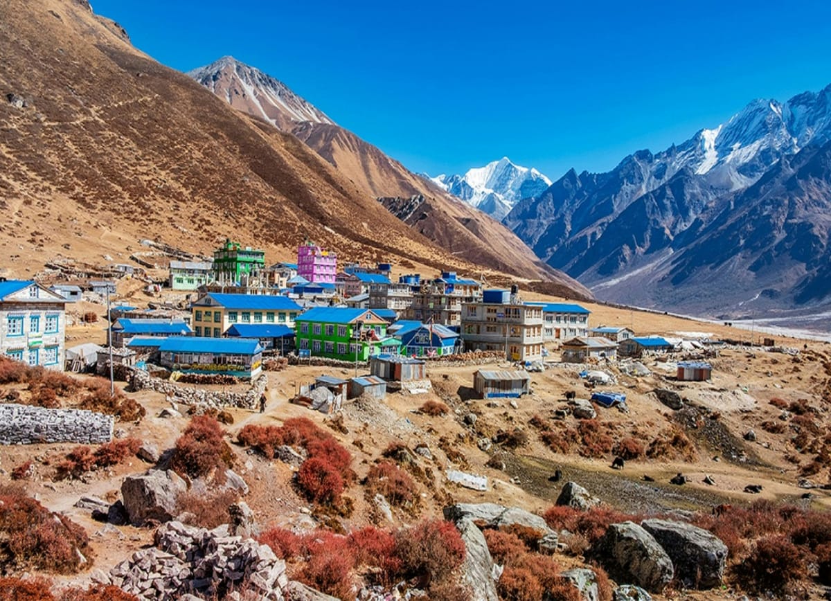
What the rebuilt village is
The new Langtang village has been rebuilt almost entirely as a guesthouse economy. Nearly every building is a guesthouse now. Three-storey lodges with WiFi, hot showers, and Western menus have replaced what was a modest farming settlement. Women in traditional Tamang dress distribute business cards to arriving trekkers.
Before the earthquake, approximately 50 families lived in the village. Fewer than 25 remain.
Nima Chhiring Tamang, who returned to the valley after the earthquake, told Al Jazeera in April 2025: 'Everyone here only cares about money and hotels now. Before life was simple, and there was peace.'
The reconstruction committee secretary, Lhakpa Tamang, was more measured: 'With business, jealousy comes. Who's gonna do better? Who is gonna earn more?' He acknowledged the irreversibility. 'When you need to go forward and develop, going back is not possible.'
The traditional livelihoods, yak herding, medicinal plant foraging, the farming calendar that structured village life before 2015, are largely gone. The earthquake destroyed most of the village's agricultural land. Tourism filled the gap. For the families that stayed, it was the only available economy.
In Mundu, the village below Langtang that was largely spared, a lodge owner lost 26 family members in the Langtang avalanche (Beyond Wild Places). He spent three months displaced in Kathmandu, returned, and spent nearly two years rebuilding. Healthcare across the valley remains inadequate: no proper clinic exists in Langtang village, and the nearest medical post, in Mundu, is staffed only by a basic paramedic.
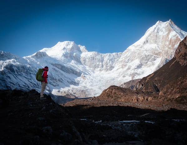
The trek itself
Langtang Valley is a three-to-five day trek from Syabrubesi, the road head accessible from Kathmandu in six to eight hours by bus or jeep. The trail gains elevation steadily: Syabrubesi sits at 1,462 metres, Langtang village at 3,430 metres, Kyanjin Gompa at 3,870 metres for those continuing further. The extension to Gosaikunda Lake adds two to three days and crosses terrain above 4,600 metres.
Since February 2025, hiring a registered guide is mandatory for the Langtang region. The regulation came out of concerns about trekker safety and pressure on local infrastructure. It has generated debate. The practical effect for most trekkers: a guided trek is more expensive and more logistically managed. The effect for local guides: a meaningful income floor, restored after the earthquake wiped out the sector.
Permits required: Langtang National Park entry (NPR 3,000 for SAARC nationals, NPR 5,000 for others) and a TIMS card. Best season: October through November for clear skies and cold temperatures, March through May for warmer conditions and rhododendrons in the lower valley. The monsoon from June through August is possible but trail conditions deteriorate.
Common questions
Is the Langtang Valley trek safe after the 2015 earthquake?
Yes. The trail has been rebuilt and is fully operational. The 2015 event was a specific seismic occurrence, not a structural vulnerability of the terrain. New building codes apply to post-earthquake construction. The route is maintained and actively trekked.
Do I need a guide?
Yes, as of February 2025. A registered guide is mandatory for the Langtang region. Trekking independently without one is not currently permitted.
How long does the trek take?
A standard trek to Kyanjin Gompa and back takes seven to ten days from Kathmandu, including travel. The trekking portion is five to seven days. Shorter versions are possible but compress acclimatisation and don't leave much time to sit with what the valley is.
How hard is it?
Moderate. The elevation gain is gradual, the trails are well-maintained, and Kyanjin Gompa at 3,870 metres is manageable for most trekkers who ascend at a reasonable pace. The extension to Tserko Ri at 4,984 metres requires reasonable fitness. The hardest part for most people is not physical.
How many people died in Langtang in the 2015 earthquake?
The official toll is 243 (175 villagers, 27 local tourism workers, 41 foreign trekkers). Local estimates are closer to 500. Many bodies were never recovered from beneath the debris field that still covers the original village site.